
Generating 3D Models
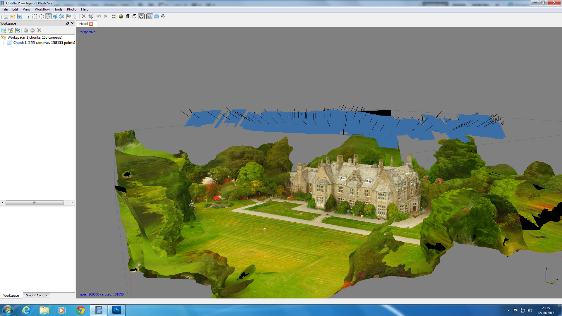
Taking aerial photos with accurate GPS co-ordinates enables the photos to be stitched together in order to re-create the 3D geometry of the original object. This can be a helpful tool for taking measurements or carrying out a condition survey of a building. In this case it was used as a model to determine the likely points of water ingress for this stately home.

Point-cloud map

Mesh generation

Orthomosaic image

Taking measurements from the geometry
